File:Google Earth.jpg
From 911myths

Size of this preview: 772 × 600 pixels.
Original file (1,280 × 994 pixels, file size: 203 KB, MIME type: image/jpeg)
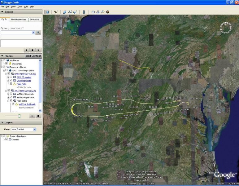
JREF forum member celestrina used NTSB data to map the flight path of Flight 77, and the last moments of Flight 93, on to Google Earth. Download it here.
File history
Click on a date/time to view the file as it appeared at that time.
| Date/Time | Thumbnail | Dimensions | User | Comment | |
|---|---|---|---|---|---|
| current | 19:41, 21 October 2007 | | 1,280 × 994 (203 KB) | Mike (Talk | contribs) | [http://forums.randi.org JREF] forum member celestrina used NTSB data to map the flight path of Flight 77, and the last moments of Flight 93, on to [http://earth.google.com Google Earth]. [[:I |
- You cannot overwrite this file.
File usage
The following 4 pages link to this file: